With more than 60 inches of snow this year, will the city dump its snow in the Boston Harbor?

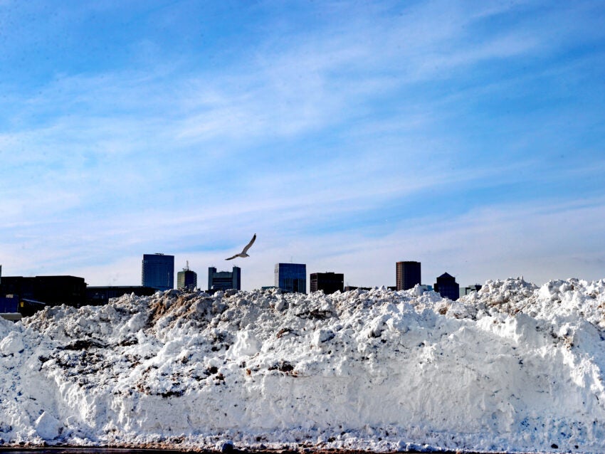
The short answer is “no,” Mayor Michelle Wu’s office said, when asked if the city would dump snow into Boston Harbor this winter. Instead, Boston will continue to rely on its network of “snow farms” to handle the large amounts of snow accumulating across the city.

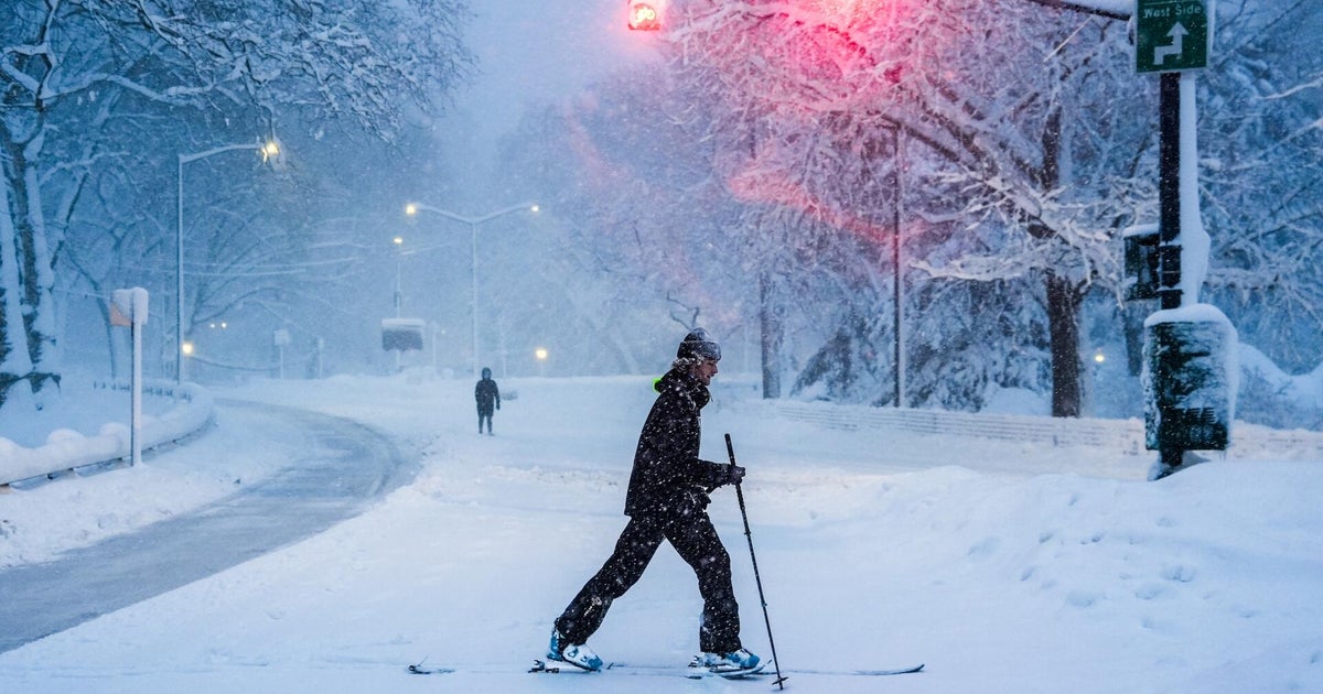
This week’s blizzard has pushed Boston’s total snowfall for the season to more than 60 inches—the highest since the infamous “Snowmageddon” of 2015. With 17 inches falling from Monday’s storm alone and more snow expected, city crews have been hard at work. As of Tuesday evening, Boston had already removed 165 loads of snow, totaling 4,620 cubic yards.

In past winters, the city sometimes resorted to dumping snow in Boston Harbor. Back in 2015, Mayor Marty Walsh considered this option as a last resort. This practice was common until the late 1990s, but as efforts to clean up Boston Harbor intensified, the Massachusetts Department of Environmental Protection banned snow dumping there in 1997—though emergency exceptions remain possible. Despite the heavy snowfall this season, the city has not needed to use this emergency measure.

Instead, Boston will make use of 14 designated snow farms located throughout the city to manage and melt the snow. These sites include West Roxbury High School, Widett Circle in South Boston, Bunker Hill Community College, Circuit Drive in Dorchester, the George Wright Golf Course in Hyde Park, and the Old Edison Plant in South Boston.

Additional snow farms are located at Franklin Park, Terminal Street in Charlestown, Bayside Expo in Dorchester, Rivermoor Street in West Roxbury, and other spots in Brighton, East Boston, and Hyde Park.

Prior to Monday’s blizzard, Boston had already received 40 inches of snow this season. During the storm, melting operations at the snow farms were temporarily paused but will soon resume to free up more space for ongoing snow removal efforts.

It’s worth noting that Mayor Walsh also relied on snow farms during the 2015 winter. One such site in the Seaport district held snow for nearly five months, with the last remnants not melting until July of that year.

With well-established snow farms and ongoing removal efforts, Boston is prepared to face this snowy winter without returning to the old practice of dumping snow in the harbor.
https://www.boston.com/news/local-news/2026/02/24/with-more-than-60-inches-of-snow-this-year-will-the-city-dump-its-snow-in-the-boston-harbor/

Blizzard slams East Coast as major cities struggle with historic snowfall

More than 40 million people were under blizzard warnings as a historic winter storm hit the East Coast with heavy snow and fierce winds. Rob Marciano, Jason Allen and Kris Van Cleave have the latest.
https://www.cbsnews.com/video/blizzard-slams-east-coast-as-major-cities-struggle-with-historic-snowfall/

50 million under blizzard warnings, NYC issues travel ban as nor’easter arrives

More than 50 million people in the Northeast are under blizzard warnings as a dangerous, rapidly strengthening winter storm moves up the coast. Emergency declarations have been made in several states. Shanelle Kaul reports on the deteriorating conditions and Andrew Kozak has a look at the forecast.
https://www.cbsnews.com/video/50-million-under-blizzard-warnings-nyc-issues-travel-ban-as-noreaster-arrives/

Blizzard conditions and high winds forecast for NYC, East coast

A powerful winter storm is expected to bring blizzard conditions and power outages along the Atlantic coast on Sunday, with some areas forecast to get more than a foot of snow. The National Weather Service (NWS) has issued blizzard warnings for millions of residents in New Jersey, Delaware, Long Island, New York City, and southern Connecticut from Sunday morning through Monday afternoon. “Whiteout conditions are expected and will make travel treacherous and potentially life-threatening,” the blizzard warning reads. “The strong winds and weight of snow on tree limbs may down power lines and could cause sporadic power outages.” Up to 17 inches of snow is expected across New York City and in a worst-case scenario, there could be nearly two feet of accumulation, according to a social media post from NYC Emergency Management. The city’s mayor, Zohran Mamdani, on Saturday morning advised residents to “stay off the roads unless absolutely necessary. If you can stay home, stay home,” Mamdani wrote on social media. He added that residents should check for updates from the city and “please check in on your neighbors.” Parts of the Hudson Valley, New Jersey and Pennsylvania are also under winter storm warnings. On Saturday, New Jersey Gov. Mikie Sherrill declared a state of emergency effective midday Sunday. Parts of Virginia, Washington D. C., and Maryland are also expected to receive snow through Monday morning. Throughout the storm, the snow is expected to be heavy and wet, and could come down as quickly as 2 inches per hour for many hours, according to the NWS. The heaviest snow is expected Sunday night into Monday. High winds with gusts as strong as 40 to 70 mph are also expected, which increase the risk of power outages and coastal flooding. Widespread flight cancellations and delays may occur at airports in affected areas, NYC Emergency Management said. The conditions are likely to taper off late Monday morning into Monday afternoon. In New York City, the Monday morning commute will be “extremely hazardous,” according to the agency. Its agency also said that schools, medical offices and workplaces may close due to the impacts of the storm: “Peak snowfall rates and peak winds will coincide, creating slippery conditions, limited mobility, and near-zero visibility.”.
https://www.npr.org/2026/02/21/nx-s1-5722292/winter-storm-blizzard-conditions-northeast

Hazardous road conditions on Staten Island as temps dip to single digits

**Staten Island Drivers Warned of Hazardous Icy Roads Amid Plunging Temperatures**

STATEN ISLAND, N.Y. — You don’t have to be gold medal figure skater Dorothy Hamill to know it’s a bit icy out there. One wrong step, and you’re halfway into a triple axel. Staten Island drivers should prepare for hazardous road conditions as overnight temperatures plunge into the single digits—a recurring theme expected to continue throughout the week.

Marc Chenard, a meteorologist with the National Weather Service, explained that temperatures will drop into the single digits each night, with some warmer areas hovering around 10 degrees. Even during the day, temperatures will remain below freezing, creating ongoing challenges for commuters.

This cold snap raises specific concerns for road safety. According to Chenard, snow that melts in the sun during daylight hours is likely to refreeze once the sun sets and temperatures fall even further. This means roads that appear safe during the day could develop dangerous icy patches overnight.

“Some roads that may be good during the day could at least have some icy spots once the sun goes down and the temperatures really start to drop,” Chenard said.

While certain road treatments can help prevent refreezing even in cold temperatures, not all roads receive such treatments. Chenard acknowledged that it’s difficult to predict exactly where or how widespread the icy conditions will be, as this depends on the condition of individual roads.

He also noted that this cold period will resemble conditions following other major storms the area has experienced, though it may be a bit colder this time around.

Drivers are strongly advised to exercise caution during overnight and early morning hours when ice is most likely to form. Staying alert and driving carefully can help prevent accidents on Staten Island’s potentially treacherous roads.
https://www.silive.com/weather/2026/01/hazardous-road-conditions-on-staten-island-as-temps-dip-to-single-digits.html

Falling temps, windy conditions in store for Thanksgiving eve and day

Macomb County and the rest of Southeast Michigan remain under a wind advisory going into Thanksgiving morning and snow is on its way too. That’s the word from the National Weather Service, which issued the advisory at 10 a. m. today. It is due to expire about 4 a. m. Thursday. Winds are coming out of the southwest at 25 mph, occasionally gusting higher to 45 mph. Meanwhile, falling temperatures and snow will be the topic of this holiday weekend. Steve Considine, a meteorologist for the National Weather Service in Oakland County, said Macomb County residents can expect a dusting to 1 inch of snow overnight. That will cause slick driving conditions for travelers driving to their Thanksgiving destinations. “We’re going to get a little bit tonight and into Thanksgiving,” he said. “Our next storm is expected Saturday afternoon and night, and that looks to bring another 1-3 inches by the time it moves out of here.” Temperatures will drop into the upper 20s overnight Wednesday and Thursday morning, which, combined with ongoing snow showers, could create icy patches on roads and sidewalks. “We’re in late November to early December, so the snowfall likely won’t stick around as the ground is still to warm,” Considine said. High winds were believed to be the cause of a set of telecommunication wires that fell on Ryan Road on Wednesday morning, according to a DTE Energy spokesperson. Police have closed the road to traffic from 10 Mile to Frazho roads while work crews assess the damage and remove the fallen lines. Windy conditions could also make driving difficult, especially for high profile vehicles. Motorsits are urged to use extra caution while on the road. The forecast for the next few days calls for:.
https://www.macombdaily.com/2025/11/26/falling-temps-windy-conditions-in-store-for-thanksgiving-eve-and-day/

Melissa strengthens into a Category 4 hurricane, threatening catastrophic flooding in Jamaica, Haiti

Hurricane Melissa Strengthens to Major Category 4 Storm, Threatening Northern Caribbean

KINGSTON, Jamaica (AP) — Hurricane Melissa has intensified into a major Category 4 hurricane, with the potential to strengthen further into a Category 5 storm Sunday night. The hurricane is unleashing torrential rains and poses a severe flooding threat across the northern Caribbean, including Haiti and Jamaica, the U.S. National Hurricane Center (NHC) reported.

The NHC added that Melissa is expected to reach the southern coast of Jamaica as a major hurricane late Monday or Tuesday morning, urging residents to seek shelter immediately.

“I urge Jamaicans to take this weather threat seriously,” said Jamaican Prime Minister Andrew Holness. “Take all measures to protect yourself.”

As of Sunday morning, Melissa was centered approximately 120 miles (195 kilometers) south-southeast of Kingston, Jamaica, and about 280 miles (450 kilometers) south-southwest of Guantanamo, Cuba. The storm had maximum sustained winds of 140 mph (225 kph) and was moving west at 5 mph (8 kph).

Heavy Rainfall and Widespread Impact Expected

Melissa is forecast to drop torrential rains of up to 30 inches (760 millimeters) on Jamaica and southern Hispaniola, including Haiti and the Dominican Republic. Some areas could see as much as 40 inches (1,010 millimeters) of rainfall.

The hurricane center warned of extensive damage to infrastructure, power and communication outages, and the potential isolation of communities in Jamaica.

After affecting Jamaica, Melissa should be near or over Cuba by late Tuesday, potentially bringing up to 12 inches (300 millimeters) of rain before moving toward the Bahamas late Wednesday.

In response, the Cuban government issued a hurricane watch Saturday afternoon for the provinces of Granma, Santiago de Cuba, Guantanamo, and Holguin.

Storm’s Slow Progress and Fatalities

The erratic and slow-moving hurricane has already claimed at least three lives in Haiti and a fourth in the Dominican Republic, where another person is still missing.

“Unfortunately for places along the projected path of this storm, it is increasingly dire,” said Jamie Rhome, deputy director of the NHC, earlier on Saturday. He added that Melissa is expected to continue moving slowly for up to four days.

Jamaica Prepares for Impact

Authorities in Jamaica announced Saturday that the Norman Manley International Airport in Kingston would close at 8 p.m. local time. It remains unclear whether the Sangster airport in Montego Bay on the island’s western side will also close.

More than 650 shelters have been activated across Jamaica. Officials confirmed that warehouses are well-stocked with thousands of food packages prepositioned for rapid distribution if needed.

Rising River Levels and Damage in Haiti and Dominican Republic

Haitian authorities reported three deaths linked to the hurricane and five injuries caused by a collapsed wall. Rising river levels, flooding, and a destroyed bridge due to breached riverbanks have been reported in Sainte-Suzanne in northeast Haiti.

Ronald Délice, a Haitian civil protection director, expressed concern about the storm’s trajectory. Local authorities are organizing lines for food kit distributions, although many residents remain reluctant to leave their homes.

In the Dominican Republic, Melissa has damaged nearly 200 homes and disrupted water supply systems affecting more than half a million people. The storm also downed trees and traffic lights, caused small landslides, and isolated over two dozen communities with floodwaters.

Threat to The Bahamas and Turks and Caicos

The Bahamas Department of Meteorology warned that tropical storm or hurricane conditions could affect islands in the Southeast and Central Bahamas and the Turks and Caicos Islands by early next week.

Season Overview

Melissa is the 13th named storm of the 2024 Atlantic hurricane season, which officially runs from June 1 to November 30. The U.S. National Oceanic and Atmospheric Administration (NOAA) had forecast an above-normal season, predicting 13 to 18 named storms.

___

Associated Press writer Evens Sanon in Port-au-Prince, Haiti, contributed to this report.

https://whdh.com/news/melissa-strengthens-into-a-category-4-hurricane-threatening-catastrophic-flooding-in-jamaica-haiti/

The Houston area faces a wet weekend after prolonged dry weather

After an extended dry spell, rain is expected to fall across the Houston area this weekend, bringing with it the chance for some localized flooding.

Isolated showers and thunderstorms are forecast for Friday, according to Bradley Brokamp, a meteorologist with the National Weather Service’s Houston-Galveston office. He said Friday morning that heavier rainfall is in the forecast for Saturday, with most of the region expected to receive 2-4 inches of rain, while some areas could get 4-6 inches.

The soil is expected to absorb more water than usual due to the recent dry weather, Brokamp noted. However, urban parts of Houston will “probably see some ponding in roadways on some spots.” “It’s Houston,” Brokamp said. “It’s a big slab of concrete that doesn’t really absorb water well.”

Saturday’s rain is anticipated to come in two waves, with the first wave arriving overnight between Friday and Saturday. A line of storms moving across Texas from west to east is also expected to bring strong winds to the Houston area and choppy waters along the Gulf Coast.

Wind could be the most significant impact to the region.

The risk for severe weather should dissipate by Sunday, Brokamp added.

Stormy weekend weather is expected across much of Texas, prompting Governor Greg Abbott to activate the state’s emergency response systems on Thursday afternoon. The governor’s office stated that many parts of the state face the “threat of severe thunderstorms including large hail, damaging winds, possible tornadoes, heavy rainfall, and flash flooding.”

“State and local emergency response partners are actively monitoring weather conditions and are on standby to provide all necessary resources to protect Texans and our communities,” Abbott said.

“Texans are encouraged to regularly monitor road conditions, make an emergency plan, and heed the guidance of state and local officials.”
https://www.houstonpublicmedia.org/articles/news/weather/2025/10/24/534181/houston-weather-rain-thunderstorms-flooding-governor-greg-abbott/?utm_source=rss-weather-article&utm_medium=link&utm_campaign=hpm-rss-link

Delhi-NCR air quality worsens; 5 stations record 300+ AQI

**Delhi-NCR Air Quality Worsens; Five Stations Record AQI Above 300**

*By Snehil Singh | Oct 15, 2025, 06:12 pm*

The air quality in the Delhi-National Capital Region (NCR) has further deteriorated, with five monitoring stations registering an Air Quality Index (AQI) exceeding 300. According to data from the Central Pollution Control Board (CPCB), Anand Vihar recorded the highest AQI at a staggering 345.

Other areas also reported alarming AQI figures: DU North Campus and CRRI Mathura Road each recorded 307, while Dwarka Sector 8 and Wazirpur reported 314 and 325, respectively.

**Pollution Response: GRAP Stage-1 Activated**

In response to the worsening air quality, the Commission for Air Quality Management (CAQM) has activated Stage-1 of the Graded Response Action Plan (GRAP) across Delhi-NCR. This comes as AQI levels have fallen between 200 and 300, categorized as “poor.”

Stage-1 implementation mandates strict preventive measures, including the deployment of anti-smog guns and dust suppression activities at construction sites to control pollution sources.

**Pollution Sources: Transport Emissions Lead**

Data from the Decision Support System (DSS) identifies transport emissions as the largest contributor to Delhi’s pollution, accounting for 19.8% of total emissions. On Tuesday, the city recorded an AQI of 201, falling under the “poor” air quality category.

For reference, the CPCB classifies AQI as follows:
– 0-50: Good
– 51-100: Satisfactory
– 101-200: Moderate
– 201-300: Poor
– 301-400: Very Poor
– Above 400: Severe

**Weather Impact**

The India Meteorological Department (IMD) noted that Delhi’s minimum temperature on Wednesday was 18.3°C — slightly below the normal of 19.6°C. This marks the fifth consecutive day with minimum temperatures under 20°C for the 2025-26 winter season. The maximum temperature hovered around 33°C.

Meanwhile, relative humidity was high at 89% as recorded at 8:30 am, factors that could further affect air quality levels.

Residents are advised to take necessary precautions as the air pollution situation remains critical.
https://www.newsbytesapp.com/news/delhi/delhi-ncr-air-quality-worsens-5-stations-record-300-aqi/story

Why Delhi’s air quality may become ‘poor’ from Wednesday

**Why Delhi’s Air Quality May Become ‘Poor’ from Wednesday**
*By Snehil Singh | October 13, 2025 | 8:30 PM*

The India Meteorological Department (IMD) has forecast a decline in Delhi’s air quality as the winter season approaches. The city’s air is expected to remain in the “moderate” category on October 13 and 14 but will likely slip into the “poor” category for nearly a week starting October 15.

According to the IMD bulletin, “The air quality is very likely to be in the Moderate category from October 13-14. From October 15 onwards, it is expected to be in the Poor category for nearly a week.”

### Pollution Update: Slight Increase in Stubble Burning

Delhi’s air quality showed a slight improvement on Sunday, with an average Air Quality Index (AQI) of 167, down from 199 on Saturday. This improvement was attributed to steady winds blowing at 10-15 km/h.

However, stubble burning in neighboring states has increased slightly, contributing to pollution levels in the city. The share of pollution from stubble burning rose from 0.4% on Saturday to 0.8% on Sunday.

The Ministry of Earth Sciences’ Early Warning System also predicts moderate air quality for October 13-14 and poor conditions from October 15 onward.

### Factors Behind the Pollution Spike

Delhi’s air quality typically worsens in October due to several reasons:

– Retreating monsoon rains and cooler temperatures
– Increased stubble burning in Punjab, Haryana, and nearby states
– Festive fireworks adding to pollution levels

Additionally, slower winds and cooler weather during this season lead to a “temperature inversion,” where a layer of warm air traps pollutants near the ground, worsening air quality. Smoke carried by north-westerly winds from Punjab and Haryana further aggravates the situation.

On Sunday, vehicles were the largest contributors to PM2.5 pollution, accounting for 19.8%, followed by emissions from Sonipat (9.2%) and Jhajjar (5.1%).

### Seasonal Outlook: Clear Skies and Cool Winds

The IMD has forecast clear skies and cool northwesterly winds over the coming days, with maximum temperatures expected to rise to 34°C by Wednesday.

Environment Minister Manjinder Singh Sirsa highlighted that Delhi has recorded 199 days with AQI below 200 this year, nearly double the number reported in 2016. He said this marks a “real improvement on the ground.”

As winter advances, residents are advised to stay updated on air quality forecasts and take necessary precautions, especially from mid-October when pollution levels are expected to worsen.

*Stay tuned for more updates on Delhi’s air quality and pollution management.*
https://www.newsbytesapp.com/news/india/delhi-air-quality-to-turn-poor-from-wednesday/story

Exit mobile version
Sitemap Index